
A clear levels report for a farm, estate or block of land you’re selling or buying. Contours, slope, wet ground and the steep corners, on one set of maps you can share.
Order for your land See a sample
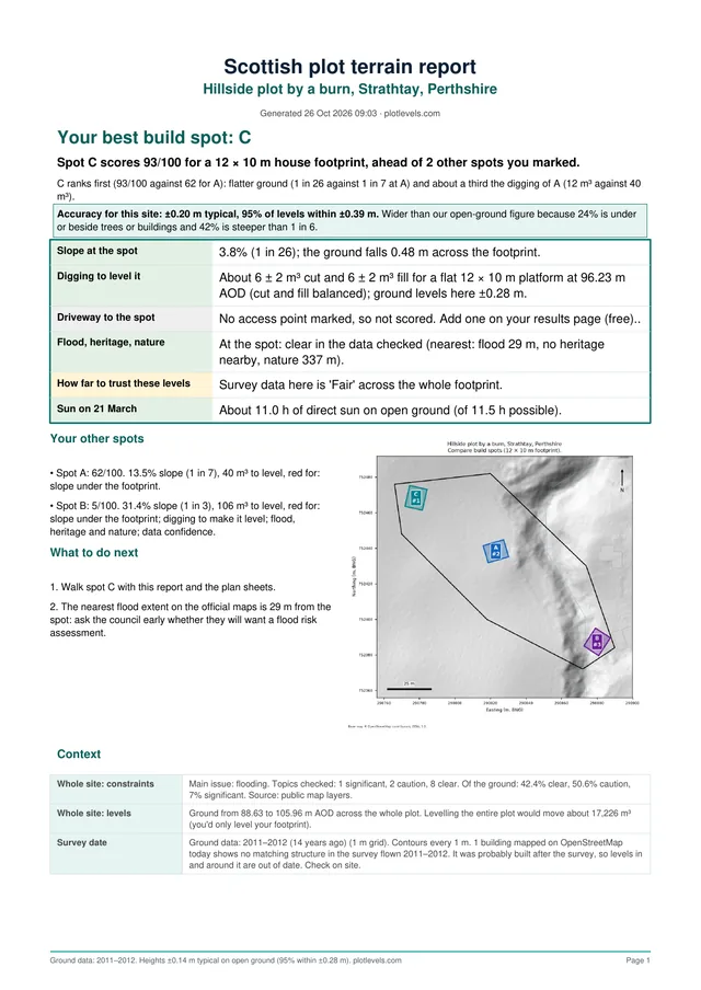
A real report page. See the full sample
Buyers ask the same questions on every farm: which fields are flat enough to work, where does the water sit, and how steep is that bank by the stream. A levels report answers them before the viewing, so the people who come out are the ones it suits.
For lotted sales it shows each lot on its own, so a neighbour looking at one block can see the ground on that block and nothing else.
Built by a team with 10+ years of surveying, DTM and drone mapping experience. Records are checked for your boundary before we deliver.
Yes. Draw the boundary of the lot you want and the report covers that area only. Each lot can have its own report.
Up to 100 hectares in one report. For a bigger estate, split it into blocks or lots and order each one.
Most reports are ready within minutes of ordering. You draw the boundary, check out, and the report and files are in your account.
Yes. The PDF is made to be shared, and the CAD files open in the drawing software most architects and land managers use.
Yes. Draw a rough outline from the map and order. When the plan is final, order again on the exact boundary.
Yes. Order for any farm or estate in Great Britain.
Draw your boundary on the map and get your report in minutes. Order for your land, or see pricing.
Related: Site levels for land agents · Rural land levels